Napier, located in the Overberg region of the Western Cape, is a small village with a rich historical heritage, founded in 1838.
The town grew out of a dispute over church location between two neighbouring farmers — Pieter Lourens and Johannes Steyn. Both wanted the community church built closer to their respective farms.
Unable to reach agreement, the farmers ultimately donated land on Steyn’s property for the church, and the settlement gradually grew around this site.
The original farm was Klippedrift, purchased by the local Dutch Reformed Church in 1838 for the establishment of the church and accompanying plots.
Napier’s design reflects early Cape settlement patterns, including ribbon (or strip) farms, where long, narrow plots extended from the river to provide equitable access to water and arable land. This layout still defines much of the town’s agricultural landscape today.
The Dutch Reformed Church became the town’s focal point, with roads and houses developing around it. The church’s construction and subsequent expansion anchored Napier as a growing community.
Early buildings in the town included farmhouses, the Feeshuis (used originally as slave quarters and later a wine cellar), and other structures tied to agriculture and settlement.
Napier was named after Sir George Napier, the Governor of the Cape Colony in the 1830s, who played a key role in the administration of the region.
Over the 19th century, Napier developed as a village of small-scale farmers, with wheat, sheep, and cattle forming the backbone of the local economy. Water infrastructure, including the leiwater system, supported the farms and ensured sustainable agriculture.
Today, Napier preserves much of its historical charm — from the Dutch Reformed Church, to the Feeshuis, ox-wagon monument, and ribbon-farm landscape — offering visitors a window into early settler life in the Overberg.
The town’s heritage is maintained through active efforts by community organisations, ensuring that Napier’s story, architecture, and landscapes are protected for future generations.
Ox Wagon Monument (Kakebeenwa Monument)
The Ox Wagon Monument in Napier, also known as the Kakebeenwa Monument, was erected in 1988 to commemorate the Ossewa (Ox-Wagon) Trek of 1838.
Its name comes from the Afrikaans word kakebeen, meaning “jaw-bone,” because the monument’s form is reminiscent of the curved shape of a jaw-bone wagon.
A striking feature of the monument is the concrete impression of a wagon wheel track, embedded in its base — this track is symbolic, representing the route taken by the trekkers during their exodus from the Western Cape.
The monument is a tribute to the courage and pioneering spirit of the Voortrekkers who participated in the 1838 trek.
It’s situated on Napier’s main road, making it very accessible to visitors passing through or exploring the town.
The Kakebeenwa Monument is not just a memorial, but a powerful visual metaphor — it evokes journey, migration, and the hardships of the trek through its design.
For history enthusiasts, it offers a tangible connection to an important chapter in South Africa’s past, especially Afrikaner heritage.
The Giant Sundial
The sundial is located at the municipal offices in Napier, making it a prominent landmark in the town.
It was erected in 1965 by Danie du Toit, who despite having no formal training, used careful observation of shadows and seasonal changes to create it.
Inspired by works of C. J. Langenhoven (a South African writer), Du Toit studied how shadows move throughout the year to design the sundial.
It is one of the largest sundials in South Africa and is the largest vertical sundial in South Africa.
The sundial is very accurate — according to sources, it is correct to within 30 seconds.
It achieves perfect accuracy twice a year, on the Winter and Summer Solstices, when the solar alignment aligns with its design.
Beyond its functionality, it’s also a symbol of Napier’s charm and ingenuity — a humble, observationally driven work that gives visitors both a practical timepiece and a piece of local heritage.
The sundial is set within a quiet, garden-like space around the municipal building, making it a pleasant spot for visitors to pause, reflect, and take in the rural calm of Napier.
The Dutch Reformed Church
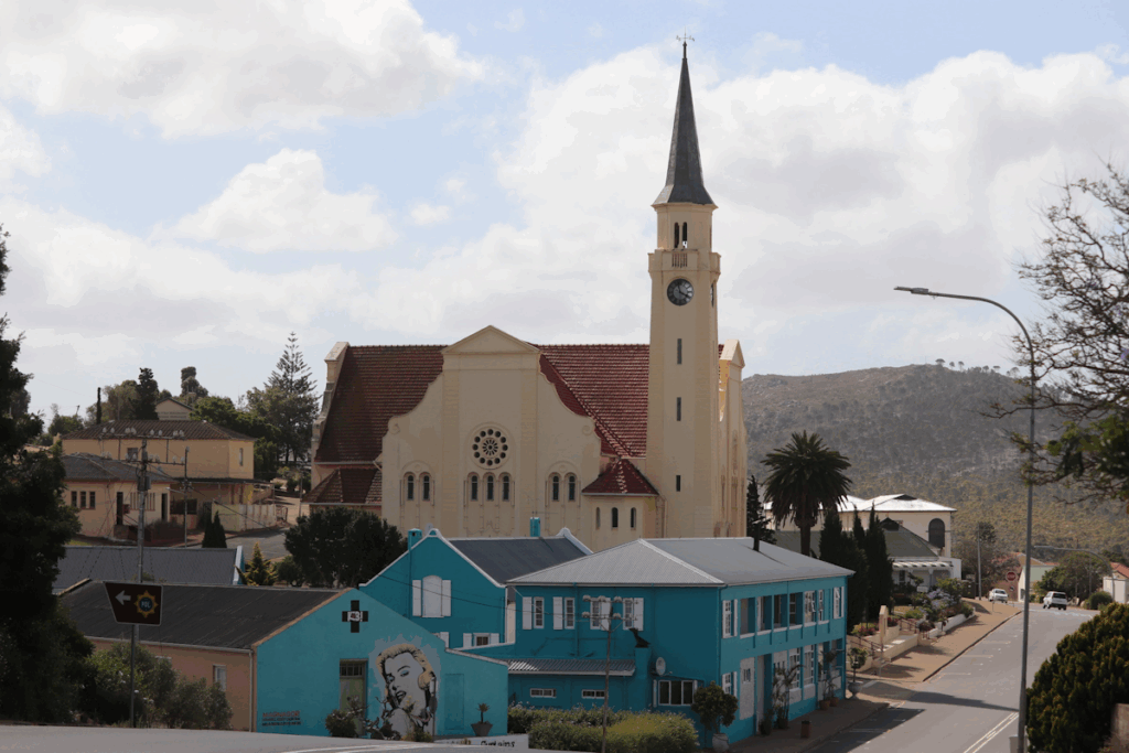
The Dutch Reformed Church is one of Napier’s most striking heritage landmarks and lies at the heart of the village’s identity.
The town of Napier itself grew around this church after a dispute in 1838 between neighbouring landowners about where a community church should be built — the settlement eventually formed around this one.
Built in a Greek cross design, the church features four equal arms, giving it a balanced and unusual architectural layout rarely seen in small South African towns.
Its interior is crafted from rich teak, creating a warm, elegant atmosphere that adds to the building’s distinctive character.
A highlight inside the church is its impressive pipe organ, noted for its solid yellow-copper pipes — a unique feature that draws both music lovers and architecture enthusiasts.
The church remains active and is known for hosting a cappella choir concerts, which make use of the building’s beautiful acoustics.
Architecturally and historically important, it was declared a National Monument in 1978, officially recognising it as one of Napier’s key heritage structures.
Located on Sarel Cilliers Street, its tall steeple and bell tower form a defining part of Napier’s skyline and act as a focal point in the village.
The church grounds contribute to the charm of the town centre, offering visitors a place to explore history, enjoy music, or simply appreciate its peaceful setting.
Feeshuis
The Feeshuis is one of the oldest surviving buildings in Napier and has deep historical significance.
Originally, during the early 1800s (circa 1810–1820), it was used as slave quarters.
After that, the Feeshuis was repurposed to serve as a wine cellar, reflecting its evolution in usage as the town developed.
In 1988, to mark Napier’s 150-year anniversary, the Feeshuis was restored to its original design.
According to the Napier Heritage Inventory Report, it’s graded Grade II for heritage, particularly due to its associations with slavery and its social/historical value.
The Feeshuis sits in Napier’s central historic core, near other heritage landmarks, making it an anchor point for understanding the town’s early social history.
Leiwater System
Napier historically had a leiwater system — an old-style irrigation canal network that carried water through the town.
This system is part of the Klippedrift River Corridor, which the Napier Heritage & Conservation Body (NHCB) is actively working to restore.
The NHCB sees this leiwater network not only as a piece of Napier’s built heritage but also as a component of its ecological heritage.
Restoring the leiwater has several aims: to preserve history, to improve water quality in the Klippedrift stream, and to re-open parts of the watercourse so it can be used as a recreational open space for the community.
In terms of broader heritage, the leiwater system links to the commonages and open space conservation efforts — it’s part of how water, land, and community life were historically interwoven.
Historic Commonage
The Napier Commonages are areas of communal agricultural land surrounding the town. The NHCB describes these commonages as a “network of agricultural commonages” that have been used by the community for nearly two centuries.
Historically, these commonage lands provided critical food-security value for Napier’s residents.
Today, many of these commonages are still in use for grain production, cattle, and sheep grazing, showing continuity in their agricultural role.
The commonage areas also include patches of Overberg Renosterveld, which is a very threatened vegetation type. The NHCB works to conserve these ecological zones alongside their agricultural use.
In terms of heritage, maintaining the commonages helps preserve not only the environmental history but also the cultural-landscape history of Napier — how people lived, farmed, and shared land over generations.
The commonages are also part of the NHCB’s effort to integrate heritage protection with conservation, recognizing that the land’s historical use, ecological value, and community importance are deeply intertwined.
Napier Gold-Mining History
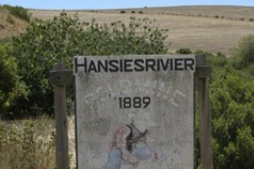
Around the turn of the 20th century, there was a brief gold-rush in the Napier area. Prospectors searched for gold on the farm Hansiesrivier, leading to the formation of the Napier Gold Mining Company.
According to historical reports, miners dug an 85-meter-long tunnel by hand along a quartz vein on the farm, hoping to extract gold-bearing rock.
Unfortunately, the gold yield turned out to be very low. Assays reportedly showed values on the order of 0.3 grams of gold per ton of quartz — far too little to sustain a viable commercial mine.
The company folded not long after being floated, making the whole gold-mining venture in Napier something of a speculative boom rather than a lasting industry.
Today, this short-lived gold-mining chapter is part of Napier’s historical narrative — a story about ambition, risk, and the limits of natural resources in this region.
Renosterveld Sites
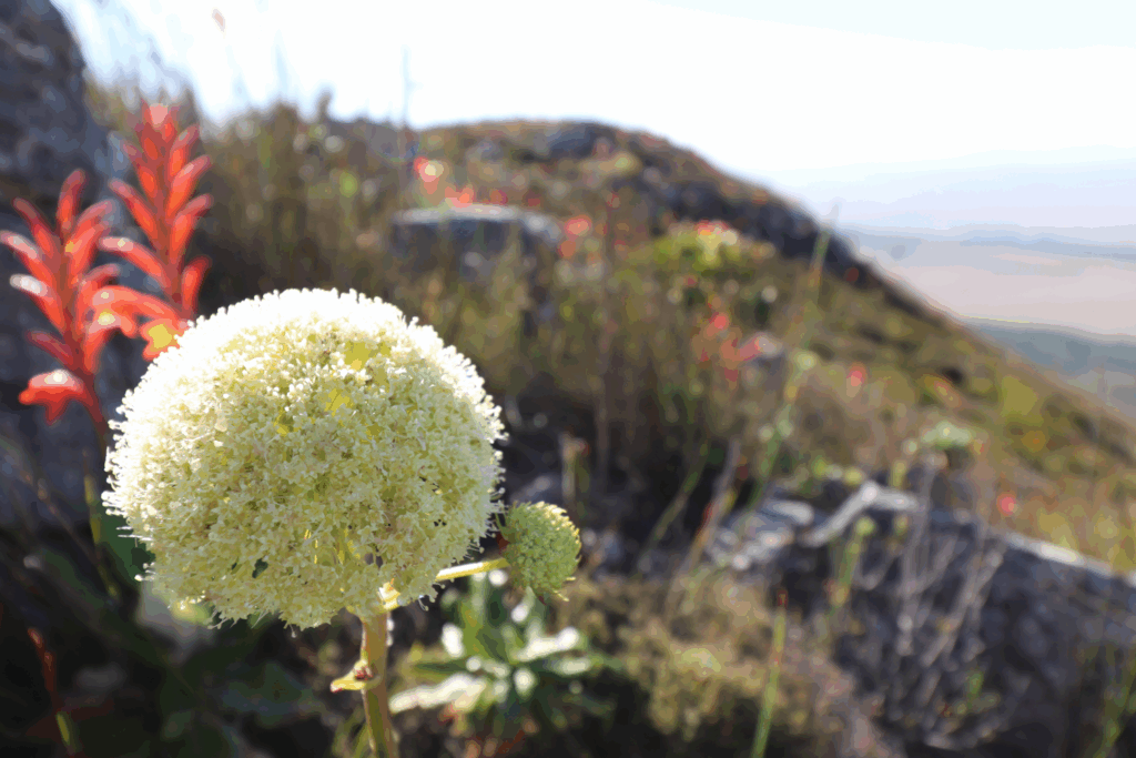
Napier is surrounded by Overberg Renosterveld, one of the world’s most threatened vegetation types.
The Napier Heritage & Conservation Body works with local landowners, botanical societies, and conservation trusts to protect patches like the Cameron MacMaster Renosterveld Reserve, Napier Ferricrete Renosterveld, and the Skurwekop Reserve on Napier’s commonages.
Renosterveld in this region is ecologically important because it supports a rich diversity of plant species, particularly bulbs (like Gladiolus, Ixias, Babiana) that are very active in spring.
Klippedrift River Corridor
The Klippedrift River Corridor (known as the Vlermuiskelderkloof Stream in its upper reaches) is both a natural and heritage landmark in Napier.
Historically, the river was central to Napier’s ribbon (or strip) farm system — long narrow plots of land extending from the river. These farms were designed so each plot had direct access to water for irrigation, forming the backbone of the town’s agricultural layout.
The river’s leiwater system ran alongside or through parts of these ribbon farms, supplying water to homes, fields, and livestock. This network reflects the careful planning of early settlers, who integrated natural waterways into their farming and settlement structure.
Today, the Klippedrift River Corridor functions as both a heritage landscape and a green space, preserving the connection between Napier’s historical strip-farm layout, its agricultural past, and its natural environment.
Visitors walking along the corridor can appreciate the integration of historic agricultural planning, river ecology, and community heritage, making it a unique insight into Napier’s development and local identity.
Ribbon (or Strip) Farm System
Napier’s early settlement layout was strongly influenced by the ribbon or strip farm system, a planning approach common in the Cape during the 18th and 19th centuries.
In this system, long, narrow plots of land extend from a central resource, typically a river or road. Each strip gave settlers direct access to water, fertile soil, and transport routes, ensuring equitable distribution of natural resources.
In Napier, the Klippedrift River and its tributaries were the lifeline for these farms. The strips allowed each landowner to irrigate crops and water livestock, often using the town’s historic leiwater system.
This pattern shaped Napier’s agricultural and social landscape, as small-scale farmers could maintain independence while still sharing access to communal resources.
The ribbon farm system also influenced Napier’s street layout and town expansion — roads often ran along the strips’ edges, creating a distinctive elongated town form.
Many of these historic strip farms still exist today, either as farmland, conservation land, or heritage sites, offering visitors a glimpse into the way settlers combined agriculture, water management, and community planning.
Walking or driving through Napier, one can see the remnants of these linear plots, their connection to the river, and how this planning method shaped the town’s enduring character.
Militaria Private Collection
This is a “Military Private Collection”.
Given the “private collection” status, it is not fully open to the public or formally structured as a large public museum. The collection may be viewed on request and Napier All Sorts.
This private collection in Napier includes military memorabilia (badges, uniforms, artifacts).
Soetmuisberg / Napier Mountain Walk & Tower Views
The mountain above Napier is often referred to as Soetmuisberg (sometimes “Napier Mountain”), and it is a key natural feature overlooking the town.
One of the most used trailheads is at the FM / radio tower located on the mountain. ShowMe SA describes a hiking trail starting at this tower.
The Grootberg Hiking Trail (8 km) is a popular route: it begins at the FM tower, goes to the “Grootberg beacon,” and then follows the ridge, giving spectacular views — on a clear day you can see all the way to the coast.
Along the way, the trail climbs to a point called Sopieshoogte, which is a good rest spot. From there, the return leg offers sweeping views across Napier and the surrounding Overberg landscape.
Wildlife and flora: The hike takes you through natural vegetation typical of the Overberg / fynbos ecosystem.
According to Napier’s conservation body, Soetmuisberg has ecological significance and is part of local efforts to protect wilderness and Renosterveld patches.
The walk / viewpoint offers a panoramic outlook: from the tower / ridge, you get views over Napier, the Agulhas Plain, and the rolling hills of the Overberg.
For hiking logistics:
There is parking at the tower per the trail description.
The trail is moderate in difficulty; the 8km route takes a few hours to complete.
It’s recommended to bring binoculars if you enjoy bird-watching; from the tower area there are good vantage spots.
Tip: Try to hike on a clear day, especially if you want to maximize the views — mountain ridge vantage points are most effective when visibility is good.
Farmhouse Ruins on the Road to Klipdale
There are ruins of a very old farmstead located on a rural road between Napier and Klipdale. The farmstead is estimated to be around 140 years old.